This blog began in late 2006 with the planning and preparation for a circumnavigation of the world in my 39-foot sail boat Pachuca. It then covered a successful 5-year circumnavigation that ended in April 2013. The blog now covers life with Pachuca back home in Australia.

Pachuca

Pachuca
Pachuca in Port Angeles, WA USA

Monday, August 31, 2009

Day 24 - Victoria Harbor

Today we motored from Saanich Bay to Victoria Harbor. After a quiet night we raised anchor at 9 AM, rounded Cordoava Spit, and headed south through Bazan Bay into the Cordova Channel with James Island to our port. At the SE corner of Victoria Island we decided to take the safer and simpler route around Discovery Island rather than the shorter but more intricate Baynes Channel and Plumper Passage partly because we did not want to risk strong currents in those tight passages. Just as well. We rounded Discovery Island at the junction of Haro Strait and the Strait of Juan de Fuca and found ourselves doing as little as 0.5 knots against the current. We increased the engine revs to 1200 and got up to 0.8 knots. I think that the current, which was supposed to be 1.1 kt in the middle of the Strait of Juan de Fuca was stronger close to Discovery Island where it had to round into Haro Strait. It seemed forever before we got away from the Discovery Island light house but at 1.30 PM our speed increased to 0.9 kt then 1.0 kt then ... ultimately up to about 4.5 kt. We can credit the 4.5 kt to Brenda's suggestion that we put out the jib against the 14 kt wind that was about 30 degrees off our port bow.

We worked our way into Victoria Harbour at about 4.30 PM not being able to raise the Wharf Manager on VHF 73 as the web site had suggested. we motored to the Causeway Floats in front of the Empress Hotel dodging boats and sea planes along the way and saw a sign giving VHF 66A as the contact. We stooged around the harbor for about 20 minutes while a berth was located for us and we then got instructions to go to the Wharf Street floats, the south side of Jetty C which is perpendicular to the shore, to where it meets Jetty D, which is parallel to the shore. We were to raft next to a boat named Esprit de Mer. We found Jetty C, crept almost to the shore before we could turn left to approach it after passing several offshoots of Jetty D, then turned left along a narrow blind alley of boats and managed to tie up safely with the help of Robert, one of the four men on the chartered Jeanneau. After we arrived two more boats were crammed into this blind alley, one rafted behind Pachuca, and a smaller one ahead of Pachuca across the narrow section of Jetty D that forms the end of the blind alley. A year ago I would not been able to creep around narrow passages of a strange marina looking for a particular boat to raft to but I guess when you gotta you gotta.

Our theory that Victoria Harbor would be somewhat free because of the impending start of the school year was sound. However, we did not plan on a yacht club booking an entire wharf in the area followed by the start of a boat festival tomorrow. Things will be tight in Victoria Harbour until next week.

We're OK. We've booked for 3 days. The day after tomorrow Esprit de Mer will move on and we will claim the jetty space which I don't find that attractive if it means another boat rafting next to ours with their crew climbing all over our boat to access the jetty. But that's boating.

----------
radio email processed by SailMail
for information see: http://www.sailmail.com

Sunday, August 30, 2009

Day 23 - Saanichton Bay

Today we motored from James Bay Prevost Island to Saanichton Bay, on Vancouver Island. Saanichton Bay is south of Sidney and about 10 nautical air miles north of Victoria. We chose this Bay because positions us close to Victoria so that we can make our arrival in that busy harbor in the early afternoon while we are relatively fresh.

It was another calm day, though an 8 kt SE wind sprang up after lunch that enabled some boats to sail. We weighed anchor at 10.30 AM and said goodbye to Don and Heather as we motored out. We then turned south and entered Captain Passage, rounded the SE corner of Saltspring Island at Beaver Point, with N. Pender Island to our port, then headed SW down Satellite Channel, and passed between Portland and Moresby islands. Soon we could see Sidney Spit to our port and the large town of Sidney to our starboard. The entire area seemed like on big and busy aquatic playground with all sorts of boats plying the waters, including ferries. Brenda agreed that the San Juan/Gulf Islands region has to be one of the best cruising grounds on the planet - not to mention the nearby fjord destinations to the north. The Whitsunday Islands of Australia are world class but they cannot match this area for scope and variety. We rounded James Island and soon dropped anchor in 13 meters of water.

We almost dropped anchor in 2 meters of water (i.e. almost ran aground). We went to the southwest of the bay instead of southwest of the spit and at 10 meters I put the engine into reverse for a few seconds to stop the boat then ran forward to drop the anchor. Just before I dropped the anchor I asked Brenda the usual question: what is our depth? It was 3 meters. "Reverse fast" I shouted. By the time the boat reversed its direction I saw 2.3 meters of depth. That was a close one. I did not pay enough attention to the contour gradient in that corner of the bay. We worked our way to deeper water (13 meters about 50 meters from the 5 meter contour) and all was well.

----------
radio email processed by SailMail
for information see: http://www.sailmail.com

Saturday, August 29, 2009

Day 22 - James Bay

Today made the passage from North Cove to James Bay on Prevost Island.

We got off to an early start at 8 AM hoping to arrive in James Bay early enough to enjoy an afternoon of exploring the park land around the bay. It was another gentle day of motoring. We rounded Pilkey Point at the NE end of Thetis Island then headed south along the Trincomali Channel with Reid and Hall islands to our port and Secretary and Wallace islands to our starboard. Along the way we got a good look at Porlier Pass with the lighthouse on the south side and the channel markers. We then passed Saltspring Island on our starboard and made a direct course to James Bay.

James Bay was all that we hoped it would be: easy entry, good holding ground, and surrounded by dense woodland. We dropped anchor half way down the southern shore in 16 meters of water and I put out all of the chain that I had available: 33 meters from the roller.

We had lunch then launched the Zodiac and went ashore for a great walk along a well-defined path through some heavy woodland. Some climbing was involved and we got spectacular views of the bay and it surrounds. While ashore we met Don and Heather, who were visiting with their boat Buenaventura1, a Hans Christian 33 out of Victoria, B.C. After dinner we visited them with a bottle of Australian Shiraz.

----------
radio email processed by SailMail
for information see: http://www.sailmail.com

Friday, August 28, 2009

Day 21 - Silva Bay to North Cove

Today we made the short passage from Silva Bay to North Cove on Thetis Island.

We made a short foray ashore for showers and internet sessions then returned to the boat to prepare the boat for departure at 11.30 AM in order to transit the Gabriola Passage at 12.10 PM, the predicted time of current reversal.

Gabriola Passage is described in the guide as "narrow, intricate and has numerous dangers in its east approach. This combined with the velocity of the tidal streams does not recommend it for general navigation. It should only be navigated at slack water, by those familiar with local conditions." However, we were to confirm that with good visibility, little wind, and passage at slack water transiting Gabriola Passage presents no serious difficulties.

We weighed anchor at 11.30 AM and motored out of Silva Bay around Shipyard Rock then turned south leaving Saturnina Island to port. We entered the passage at 12.15 PM as part of a two-way procession of boats that were making the crossing at slack water. Of course this made our navigation much easier. We were through the narrows in about ten minutes, saw Degnen Bay to our starboard, rounded the light at Dibuxante Point then turned south in the Plyades Channel down the west side of Valdes Island. Everybody was motoring because the air was very light. The calm water made for easy motoring with the autopilot doing the steering while we enjoyed the sights and had lunch in the cockpit.

We left De Courcy, Ruxton, and Plyades islands to starboard then headed SSW through the Trincomali Channel, rounded the Ragged Islets beacon, and entered North Bay in very gentle conditions. We dropped anchor and 20 meters of chain in less than 10 meters of water.

The bay was very busy. There was a lot of youth activity in the SW corner of the bay with speedboat dragging squealing children on an air mattress, dingy sailing, swimming, etc. Later we heard a sea plane start its engine. I went topside and saw what looked like the same plane that had given us a hard time the previous day gun its engine and take off. The activity and housing does not bother us because we are happy enough with a tranquil and safe anchorage with spectacular scenery all around us.

----------
radio email processed by SailMail
for information see: http://www.sailmail.com

More Photos from Vancouver


These photos were sent by Angelika.


approaching the dinghy dock - False Creek


Spanish Banks


Spanish Banks - Lighthouse Park at top centre


B.&R. surveying howe Sound


Brenda looking at Point Grey


Stanley Park - Prospect Point raccoon


The whole family


Thursday, August 27, 2009

Day 20 - Silva Bay

It was another clear, sunny, and warm day. We went ashore this morning and had showers then washed a load of laundry. After lunch I emptied out the 20 liters of spare diesel fuel into the main tanks then motored to the fuel dock to fill them up again. The fuel cost $25.00 and I noticed that the next pump had $720 on it.

We then set off on the Zodiac for some exploration of the area. We took the non-navigable channel between Tugboat and Sear islands then circumnavigated Sear island. Proceeding up the very narrow "Small Boat Passage" between Sear and Gabriola Island I considered then rejected the idea of shutting down the outboard motor and drifting quietly with the breeze back to Silva Bay. Good thing I didn't. I heard a roar and saw only about 300 meters away the sea plane at full revs heading our way for a takeoff. I altered course for the shore but the plane was gaining speed and I had to use the throttle to clear the channel quickly. The plane lifted off maybe 30 meters behind us. I'm pretty sure that the pilot knew that we were there and had evasive moves up his sleeve, and I am just a sure that he uses this technique to clear his air strip of unsuspecting visitors in small boats.

We then motored through Silva Bay and past Pachuca and landed on Vance Island after being attracted by a wild deer and a derelict shack. We walked through the heavily wooded island to the other side to get spectacular views of the Strait of Georgia and the snow-covered mountains on the mainland. There were plenty of otters in the water. We then circumnavigated Vance Island and returned to Pachuca.

We returned to shore at 6.30 PM and I was able to use the local WiFi to upload some photos of Silva Bay. Then we had dinner at the restaurant which has spectacular views, reasonable prices, and great service.

We have found Silva Bay to be a delightful place and are glad that we decided to spend the extra day here.

----------
radio email processed by SailMail
for information see: http://www.sailmail.com

Photos from Silva Bay


The first photo is looking past Gabriola Island across Georgia Strait to the mainland. Notice the snow on the peak of the mountain behind the sail boat.

The next photo shows the commercial part of the Silva Bay community.

Then there is a photo of the narrow non-navigable waterway between Sear and Tugboat islands. We took the Zodiac down that waterway.

The fourth photo is of some of the floating houses at False Creek, Vancouver. The other photos are of the Silva Bay area.

We spotted the wild deer on Vance Island from the Zodiac.


The finals shot is the obligatory photo of Pachuca at anchor in Silva Bay.

Wednesday, August 26, 2009

Day 19 - Vancouver to Silva Bay

This was the day for saying farewell to Vancouver and motoring from False Creek to Silva Bay on Gabriola Island, about 20 nm on the other side of Georgia Strait. Vancouver represented Pachuca's northern-most anchorage, at 49 degrees 16 minutes North. (Hopefully one day she will reach the Horn at 56 degrees South.)

In the morning we made a quick visit to Granville Island for some last minute shopping and internetting. We weighed anchor at about 11.30 AM then motored to the False Creek Yacht Club reception jetty to notify them of our departure and to fill our water tanks for the first time since Port Townsend. We were underway at 12.15.

In English Bay I hoisted the mainsail in the hope that we would be able to do some sailing off a 10 kt NW breeze. However, this was not to be. We rounded Pt. Grey to find a 10 kt apparent wind on the nose. An hour later the wind had died to the point where the sea was smooth and oily so I dropped the mainsail and we motored all of the way to Silva Bay.

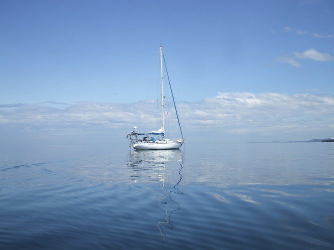
We spotted the light at Thresher Rock, which marks the beginning of the Gabriola reefs, and left it to port and proceeded through Commodore Passage. We rounded the post at Shipyard Rock in the very narrow channel between Vance and Tugboat Islands and at 6 PM we dropped anchor and 17 meters of chain in 8.1 meters of water. We were pleased with ourselves. We might have been over cautious, over analytical, over talkative, and over worrying about our navigation, but we had found our target, negotiated the turns and passages, and dropped anchor in the right spot without dramas, close shaves, near misses, or mishaps. We could thank Dieter for Silva Bay because when we read about the nearby Gabriola Passage two weeks ago it looked too difficult and dangerous for us. The narrow passage (about 50 meters) around Shipyard Rock would have freaked us out. However, once Dieter showed me that it could be done and how to do it we had the confidence to give it a go. Silva Bay is surprisingly sheltered, and is developed with a marina, shop, pub, etc, and populated with a surprising number of boats.

After Captain Robert did his Due Diligence and watched the anchor settle for 20 minutes - beer in hand of course - the Zodiac was launched and the crew went ashore in quest of ice and showers.

Why ice? The bad news of the trip is that we confirmed that the refrigerator has quit working again. It is the same syndrome: compressor running continually, but no cooling. I think that it has developed another gas leak and will have it looked at by Doug Roth in Port Townsend. Fortunately we made it to the store before the 7 PM closing time and were able to purchase a block of ice.

The good news of the trip is that while Brenda conned the boat I was able to clear sole area at rear of the boat between the quarter berths and inspect the below-cockpit area while the engine was running. I opened the door to that compartment and immediately heard a regular "hiss hiss hiss" sound - steam escaping from the exhaust. I put an old towel over the batteries and squeezed myself as far aft as I could. I could not get my head to the back of the batteries to look down but I could get my arms back there. So using a light and a mirror I had a look. The steering system is not leaking. However, there is a constant shower of water falling from the engine exhaust muffler. The muffler could be split but I am betting on either a loose clamp or split hose. In any event, it looks like I have found the source of another of Pachuca's leaks, and this one bringing in water at the rate of about 20 Whale Gusher strokes per hour. I suspect that I have had this problem since Fremantle, which begs the question of why I have waited so long to make this check. Slow learner, I guess. Anyway, I hope to have this attended to in Port Townsend, with me contributing grunt power to get those massive batteries out of the way. Fixing this problem will be another BIG step in the long campaign to de-leak Pachuca.

Unfortunately the restaurant and showers were closed for maintenance work so we retreated to the boat. Brenda and I had red wine in the cockpit watching the sun fade over the amazingly serene anchorage, followed by a hot pressure cooker dinner. Life was good.

----------
radio email processed by SailMail
for information see: http://www.sailmail.com

Tuesday, August 25, 2009

Day 17 - Nigel and Patrick


At 11 AM on Monday, our fourth day in Vancouver, we met Nigel and Patrick at the dinghy dock under the Cambie bridge. Nigel is a cousin of Caroline and Miles back and Perth, and I have known them for perhaps close to ten years.

It was another bright, sunny, and warm day and we took the scenic drive to Stanley Park then had a pleasant walk along the sea shore to get to "The Tea Rooms" restaurant where we enjoyed splendid lunch over a bottle of chardonnay courtesy of Nigel and Patrick.

After lunch we visited the marina and promenade at Coal Harbour where we had leisurely stroll enjoying the weather and the sights.

We returned to the dinghy dock to give Nigel and Patrick a tour of Pachuca and Captain Robert made the less-than-wise decision to transport the entire group to the boat on the Zodiac. Bottoms got wet (including Captain Robert, who deserved it) but we reached the boat without major mishap.

We spent about an hour on the boat sipping beer and discussing various aspects of the boat.

Before they departed Nigel and Patrick presented us with a bottle of 2005 icewine from the Gehringer Brothers Estate Winery of Oliver, B.C., in an elegant wooden case. They also presented us with very cute "Sumi" 2010 Winter Olympic Games mascot. We have already found a safe and visible home for him on a shelf next to the ship's clock. This was accompanied by a very appropriately worded card that we will tape to a bulkhead. These were very thoughtful gifts that were a complete surprise to us and Brenda and I greatly appreciated their sentiment.

I am looking forward to seeing Nigel and Patrick again at Fremantle.

The top two photos are of us at the restaurant.

The last three are of the visit to Pachuca.

Days 15 and 16 - More Photos


Here are more photos from our outing with Dieter and Angelika.

The first photo is of Howe Sound.

The third photo is of Vancouver across Burrad Strait.

The raccoon was at "Lost Lagoon" at Stanley Park.

I think that the lighthouse is at Point Atkinson.

The photo in the last photo is on its way to Vancouver Island.

Days 15 and 16 -Dieter and Angelika


On the afternoon of our second day at False Creek we met Dieter and his wife Angelika at the dinghy dock under the Cambie Bridge. I had met Dieter at Hilo and then saw him again at Ala Wai boat harbor in Honolulu over a period of about 3 months, during which time Brenda met him. It was good to see Dieter again and I was looking forward to discussing with him our Pacific Ocean crossings. After greeting Angelika I introduced her to Brenda and soon we were off on a visit to their home.

Before dinner Brenda and I had showers, a hospitality that all experienced cruisers will understand. Dieter took me upstairs to the work room and showed me how to use the Canadian current tables then gave me very good information on entering and cruising the Gulf Islands. After a splendid dinner over red and white wines and plenty of interesting conversation it was time to return to Pachuca.

The next morning at 11 AM Dieter and Angelika picked us up and gave us a comprehensive tour of the Vancouver area from False Creek to Horseshoe Bay on Howe Sound, where we had lunch. After lunch we had a walk of about two hours in the heavily wooded Lighthouse Park. Dieter and I tended to talk about boating while Brenda and Angelika other common interests. During the walk Brenda saw her first squirrel and later, at Stanley Park, saw her first raccoons. At the end of the day Brenda and I felt that we had good grasps of the layout and features of the Vancouver area. There is no substitute for good local knowledge for learning about a city.

When we said our good byes I felt that we had all had an enjoyable two days, and Brenda and I were certainly grateful for the wonderful hospitality of these two fine people.

The top photo is of the four of us at Horseshoe Bay.

False Creek


Some photos of False Creek.

The top photo is of an entertaining magic show put on by a busker at Granville Island.

The middle photo is of the end of False Creek as seen from the Cambie bridge, the third bridge that we could not pass.

The bottom photo is of the False Creek anchorage as seen from the Cambie bridge. The Granville and Burrad bridges are in the background.

Entering False Creek


The accompanying photos are of our entry into False Creek on Day 14, 21 August.

The first photo is a ship that cut very close across our bow at Boundary Passage as we approached Saturna Island.

The others show our approach into False Creek, under the Burrard then Granville bridges.

Because of the crowded anchorage and fading light we anchored with smaller space than we would have liked but the next morning the boat downwind from us moved out and we were able to move Pachuca 30 meters downwind and put out 20 meters of chain.

The final photo shows Pachuca happily at anchor.

Farewell Klaus


My friend Klaus Krist died in Honolulu on August 19 from complications arising from congestive heart failure. . His good friend Elfriede notified me by email.


Arnold and I met Klaus in early March when we visited the condo on the beach at Punaluu in which he had lived in the 1970's. In the corner apartment on the ground floor, just meters from the beach was a man doing some house painting and we struck up a conversation. Like Arnold, he had lived there many years before and had recently returned. That was Klaus. Although he was busy preparing for company he expressed great interest in our sailing adventure and asked for my telephone number. Klaus had had a boat built in California in the 70's or 80's and had sailed it to Hawaii.

He telephone me a few days later and soon he boarded the bus to Honolulu and visited me on Pachuca where I gave him a tour of the boat and showed him photos of our cruising adventures. By then Arnold had returned to Seattle.

Klaus and I became good friends. We "clicked", as they say. We both enjoyed a good beer and seemed to continually laugh about all sorts of things. We met several times in Honolulu and once I visited him for lunch in his veranda over beer with the sounds, sights, and smells of the beach which was only meters away.

Klause was not in the best of health. He had had a heart operation several years earlier and was short of breath. Several times he wondered why he had these health problems when he was only a few years older than me and here I was sailing around the world. I told him that I could not explain it. But even then he was a tall, well-built man and still good looking enough to remind all of what a handsome man he would have been in his prime. I also remember him telling me several times "I wish that we should have met 20 years ago." and also "Live life while you can."

Klaus expressed an interest in going for a sail and it so happened that Jeff Compton and I wanted to take Pachuca out for a trial of the new Monitor wind steering that he had helped me to install. So One ofternoon it was Klaus, Jeff, and myself sailing off Waikiki Beach in a 15 kt wind.

I knew Klaus for only a few months but I feel fortunate for that. There is something about friendship that resonates in the human psyche and that transcends time or space. It's like we always knew each other.

But life must go on. I like to think that Klaus went out peacefully with a smile on his face. The accompanying photo, happy at the helm of Pachuca, is how I like to remember him.

Thursday, August 20, 2009

NW Cruise Day 14 - False Creek

Today we sailed from Bedwell Harbor to False Creek, in the heart of Vancouver, BC.

We raised the anchor at 9.30 AM and motored well clear of the land, then raised all sail and turned ENE along Boundary Pass against a moderate SE wind. We were sailing well through the water but our COG was only 2.1 kt due to the adverse current. Several times the water was so roiled by the current that it seemed as though we were sailing in a river rather than a deep passage.

Steadily the effect of the current diminished as we had expected and we found ourselves having a splendid sail in a warm, sunny, and almost cloudless day. Canada with South Pender and Saturna islands was to our port, and the USA with Waldron, Sucia, and patos islands was to our starboard. During the passage between Saturna and Pender islands we ran the for about 20 minutes when we thought that the wind was dying.

Once we were in the Strait of Georgia we headed NW running as close to downwind as possible without allowing the headsail to be blanketed by the mainsail. A few hours we gybed, they gybed again when we had crossed the Strait of Georgia. Our speeds were over 5 kt, usually over 6 kt because of the assistance of the favorable current. Our final run past Lulu Island to Point Grey at the entrance to Vancouver was outstanding: several hours of 7+ knots on a starboard beam reach. The wind started to die down as we approached Pt. Grey and we started the engine 6 miles out, when our speed had dropped to 4.1 kt. The wind picked up again and between the engine and sails we reached Pt. Grey doing a full 8 kt.

We then dropped our sails and motored into the wind past English Bay looking for the entrance to False Creek. This proved more difficult than we had expected. The entrance was difficult enough to find but the search was made more challenging because we were forced to dodge a plethora of sail boats, Kayaks, and fishing boats. We eventually found the entrance followed another sail boat under the Burrard & Granville Bridges and dropped anchor
at about 8.15 PM, just after sunset, in 7 meters of water.

An hour later we had a fine meal in the cockpit under the sparkling lights of Vancouver, over a bottle of superb Condingup Vineyard Shiraz sent as a gift by Christine from her and her husband Jim's vineyard East of Espernance in Western Australia.

----------
radio email processed by SailMail
for information see: http://www.sailmail.com

Wednesday, August 19, 2009

Bedwell Harbor


Bedwell Harbor is a fine natural harbor with plenty of anchoring space. The center of activity are the resort and the hotel. Both places have been very helpful to us.


At the resort they exchaged our US dollars for enough loonies for showers and laundry. We had lunch over white wine at the hotel terrace overlooking the harbor, and now here I am on the third floor at a luxurious desk using their computer to send this blog.

The top photo shows the use of the small webtop computer while under way. If you zoom in on the chart plotter you will see that Canada (at the left of the screen) is not shown in detail because I did not want to fork out another $400 for another chart cartridge to use for only a week or two. We are using C-Map on the webtop. It is resting on a cushion to protect it from the engine vibrations.
The chart plotter is still useful for a gross picture of where we are, for anchor watch, and for plotting the AIS targets.
The second and third photos are of the anchorge, taken from Pachuca.
The fourth photo from the top shows the Customs jetties and the Customs house on the right.
The second-last photo shows Pachuca, the anchored boat at the extreme right.
I took the last photo from the terrace where we had lunch.
We had relatively high winds last night and in the early morning, up to 18 knots according to my instrument. The anchor held well with 33 meters of chain out in 12 meters of water.
We expect to leave very early in the morning to make the long stretch to Vancouver in one go, with the help of the current.


Photos of Roches Harbor


Here are a few more photos or Roche Harbor, out of Brenda's camera.


The large black boat was one of the many ... small ships really ... that we have been seeing lately. I categorize them according to the number of large communications domes that they carry. This one had three big ones and many smaller ones.


The granite art work is named "window", from the town's large outdoor art display/gallery.


And no set of photos is complete without one of the historic Hotel de Haro.

Blog Archive

Contributors

Statistics Click Me