I've got a 1-year-old Toshiba laptop running XP. It has only USB port connections - no DB9 connections found in the older laptops. This has caused a problem with interfacing the boat's GPS's with the laptop, which is running CMap 4.
On Tuesday I purchased a GPS receiver (No brand, part number BU-353) that is in the shape of a flying saucer about 25mm in diameter. It is heavily magnitised and can also be attached with a suction cup. It has a USB connector.
After two hours of fiddling I got the system to work. The receiver sends NMEA-0183 sentences to the laptop. A driver supplied with the receiver manages the USB port in the laptop. CMap 4 was configured to look for the data at the particular port (com4: in my case).
The receiver performs as advertised. It had no trouble acquiring satellites from inside a house with a tile roof, or on a shelf at the navigation table inside Pachuca. It achieves fixes in amazingly short time.
On Pachuca CMap 4 displayed the location of the boat at the 11th double-boat bay of the NE side of D jetty. We checked and sure enough Pachuca is in the 11th bay from the end.
The unit cost me $129 AUD (i.e. Aussie dollars).
I've also ordered a USB-DB9 conversion cable to attempt to connect the Trimble NT200D GPS to the laptop. I figure that redundancy is worth the $49 AUD cost of the cable.
The next task is to visit the PC shop and get a transformer to allow me to run the PC off the boat's 12V system.
Pachuca
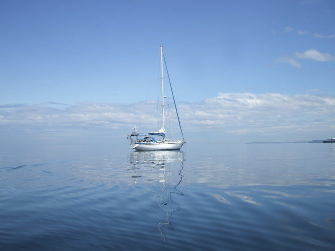
Pachuca in Port Angeles, WA USA
Wednesday, January 10, 2007
Wednesday, January 3, 2007
List of things to do or get
This is a list of things to do or get given the current state of the boat, equipment on hand, and gaps in my knowledge. Some of the items are trivial (e.g. steering wheel cover), and some are major (e.g. wind generator) - Robert
| Circumnavigation "To Do" Check List - V1.0 | ||
| TASK | COMPLETED | COMMENT |
| Install sound system | ||
| Book case for large books | ||
| Lee cloth for port cabin bunk | ||
| Lee rails for quarter berths | ||
| Tool storage and work area | ||
| Water maker | ||
| Wind Generator | ||
| Replace cushion in stbd quarter berth | ||
| Lightning protection for boat | ||
| Get oven to work | ||
| Laptop with C-Map 4 and GPS input | ||
| Modern EPIRB for boat | ||
| Personal EPIRBs | ||
| Survival suits | ||
| 4-man life raft | ||
| Select cruising anchor | ||
| Mainsail roller slides and track lubrication | ||
| New jib sheets | ||
| Storm trysail | ||
| Drogue | ||
| Install stb Whale Gusher bilge pump | ||
| Radar? | ||
| Rail spray dodgers | ||
| Outboard motor cover | ||
| Steering wheel cover | ||
| Replace companionway spray dodger | ||
| First aid course | Robert and Arnold | |
| Medical Kit | Advice from Arnold | |
| Learn to use Pachuca's spinnakers | ||
| Conversational Spanish and French | Robert - and Arnold? | |
| Courtesy flags of likely host countries[1] | ||
| Learn about Diesel engines | ||
| Diesel spares | ||
| Steering: How it works, spares | ||
| Emergency steering lever | ||
| Visas and visiting protocols | ||
| Communications: e-mail | ||
| Communications: Weather fax | ||
| Fishing Gear | ||
| Lifeline down centre line of boat | ||
| Robust radar reflector (or transponder) | ||
[1]
Robert Morales:
NZ, French, US, Panama, Peru?, Chile?, British, South Africa
NZ, French, US, Panama, Peru?, Chile?, British, South Africa
Circumnavigation Plan V2.5
Note: I have been forced to change the template of this blog to get enough log display width to accommodate the entire circumnavigation plan - Robert
| Pachuca's Circumnavigation Plan V2.5 | |||||||||
| From | To | Dist Nm | Sailing Days[1] | Stop Over Days | Total Travel Days[2] | Depart Date | Arrival Date | Core Storm Season | Avg Speed in Knots[3] |
| Fremantle | Adelaide | 1360 | 20 | 3 | 23 | 01-Mar-08 | 21-Mar-08 | 2.78 | |
| Adelaide | Port Phillip[4] | 540 | 8 | 3 | 11 | 24-Mar-08 | 01-Apr-08 | 2.78 | |
| Port Phillip | Whangarei NZ | 1600 | 24 | 7 | 31 | 04-Apr-08 | 28-Apr-08 | Jan-Mar (Nov-May)[5] | 2.78 |
| Whangarei [6] | Tahiti | 2600 | 39 | 7 | 46 | 05-May-08 | 13-Jun-08 | 2.78 | |
| Tahiti | Honolulu | 2600 | 39 | 7 | 46 | 20-Jun-08 | 29-Jul-08 | Jul-Sep (May-Nov)[7] | 2.78 |
| Honolulu | Juan De Fuca[8] | 2290 | 34 | 58 | 92 | 05-Aug-08 | 08-Sep-08 | Jul-Sep (May-Nov) | 2.78 |
| Juan de Fuca | San Diego | 1100 | 17 | 3 | 20 | 05-Nov-08[9] | 22-Nov-08 | Jul-Sep (May-Nov) | 2.78 |
| San Diego | Galapagos | 2513 | 38 | 3 | 41 | 25-Nov-08 | 02-Jan-09 | 2.78 | |
| Galapagos | Valparaiso[10] | 2229 | 33 | 3 | 36 | 05-Jan-09 | 07-Feb-09 | 2.78 | |
| Valparaiso | Cape Horn[11] | 1800 | 27 | 0 | 27 | 10-Feb-09 | 09-Mar-09 | 2.78 | |
| Cape Horn | Falklands | 435 | 7 | 3 | 10 | 09-Mar-09 | 16-Mar-09 | 2.78 | |
| Falklands | Cape Town | 4320 | 43 | 7 | 50 | 19-Mar-09 | 01-May-09 | 4.17 | |
| Cape Town | Fremantle | 4870 | 49 | 0 | 49 | 08-May-09 | 25-Jun-09 | 4.17 | |
| Avg Speed Knots | 3.1 | ||||||||
| Distance Sailed Nm | 28257 | ||||||||
| Days Under Sail | 378 | ||||||||
| Lay Days | 104 | ||||||||
| Days Away | 482 | ||||||||
[1]
Robert Morales:
Assumptions:
1. Multiply sailing distance by 1.2
2. 80 nm per day travel
Except for Falklands-Cape Town-Fremantle legs where I assume 120 nm per day due to favourable current and winds
Assumptions:
1. Multiply sailing distance by 1.2
2. 80 nm per day travel
Except for Falklands-Cape Town-Fremantle legs where I assume 120 nm per day due to favourable current and winds
[2]
Robert Morales:
Includes port stay
Includes port stay
[3]
Robert Morales:
This is speed over 1.2 x distance in col C
This is speed over 1.2 x distance in col C
[4]
Robert Morales:
Near Melbourne
Near Melbourne
[5]
Robert Morales:
Parenthesis includes periods affected by early or late seasons.
The affected area includes: Fiji, Samoa, North island of NZ
Parenthesis includes periods affected by early or late seasons.
The affected area includes: Fiji, Samoa, North island of NZ
[6]
Robert Morales:
NE coast of North island of New Zealand
NE coast of North island of New Zealand
[7]
Robert Morales:
"North East Pacific" but principally the west coasts of Mexico and California
"North East Pacific" but principally the west coasts of Mexico and California
[8]
Robert Morales:
Puget Sound/Seattle
Puget Sound/Seattle
[9]
Robert Morales:
That's 2 months in Seattle.
The 5th because it is the day after our birthday.
That's 2 months in Seattle.
The 5th because it is the day after our birthday.
[10]
Robert Morales:
Callao, Peru (near Lima)? It is supposed to be the best anchorage on the Westen side of South Amierica
Callao, Peru (near Lima)? It is supposed to be the best anchorage on the Westen side of South Amierica
[11]
Robert Morales:
Best to round the Horn in Dec or Jan
Best to round the Horn in Dec or Jan
Subscribe to:
Posts (Atom)